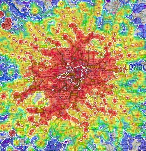
From Nixon*Now comes this color-coded map showing how long it takes to get from one area of London to another. He says:
"These are much more complicated questions than those about individual journeys, but one thing they all have in common is transport: can I get to and from the places I'm considering quickly and easily?"Basically, this answers the question of "how early do I have to get up to work on time?" Now if only someone would make this map for the New York subway system. More at mySociety.
The maps on this page show one way of answering that question. Using colours and contour lines they show how long it takes to travel between one particular place and every other place in the area, using public transport. They also show the areas from which no such journey is possible, because the services are not good enough."
1 comment:
"The maps on this page show one way of answering that question. Using colours and contour lines they show how long it takes to travel between one particular place and every other place in the area, using public transport. They also show the areas from which no such journey is possible, because the services are not good enough."
Huh? How can there be one time for travel between a place and every other place in the area? I can't make heads or tails of what that's supposed to mean. And how can bad services make a journey impossible, rather than merely time-consuming?
Post a Comment